MASTERSTUDIENGANG - ENVIRONMENTAL DESIGN
Haifa – Kiryat Eliezer
The Green ConnectionHaifa – Kiryat Eliezer
Meike Wilkens, Jasmin Zorn, Winter semester 2022/2023
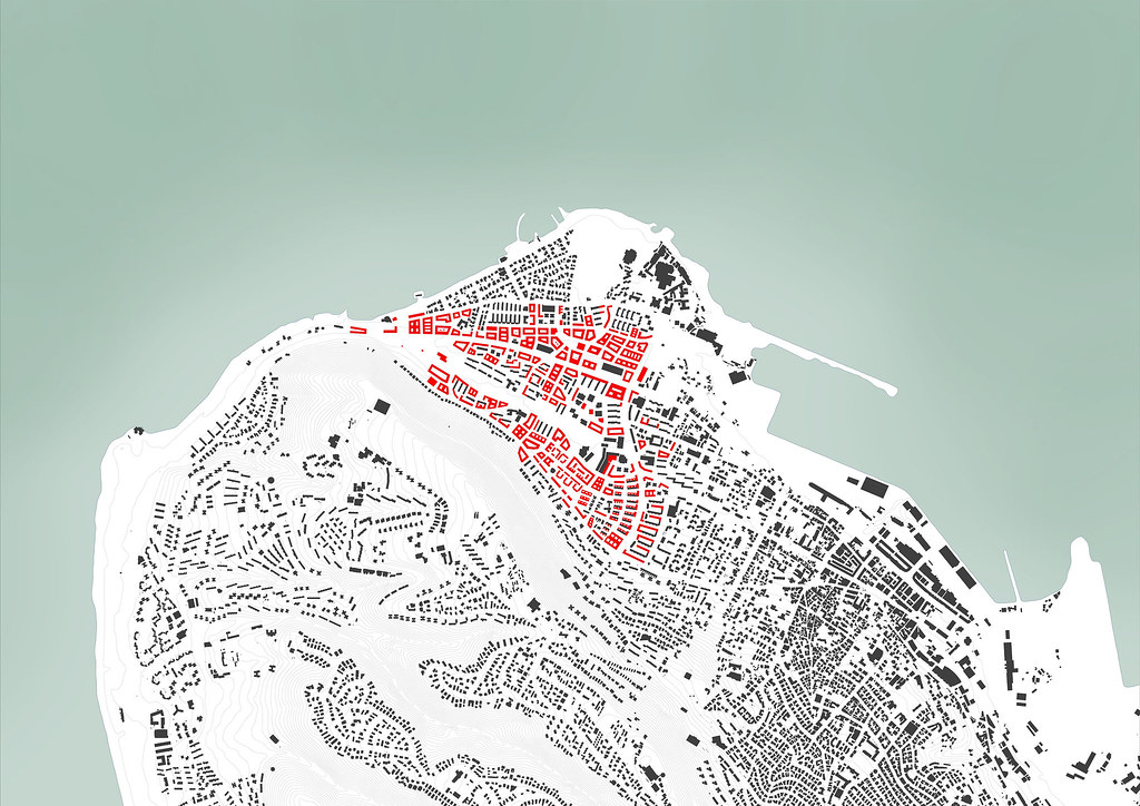
Located near the shoreline of the Haifa in Israel, we find the district Kiryat Eliezer. Because the area consists almost exclusively of housing from the 1950s, the found density here is rather low. The majority of the buildings are placed wide apart and a big percentage of the surface area remains empty and unused.
Because of the growing population, this district needs to be recompressed, just like the surrounding areas already are.
The new Kiryat Eliezer
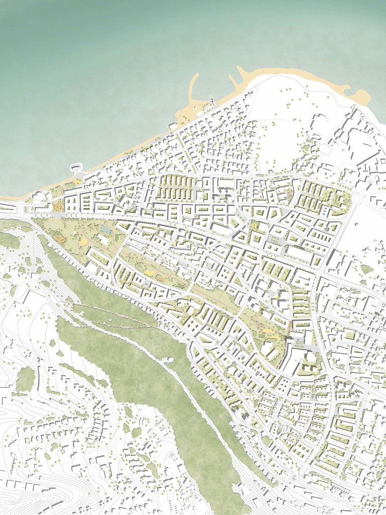
Scale 1/2,000
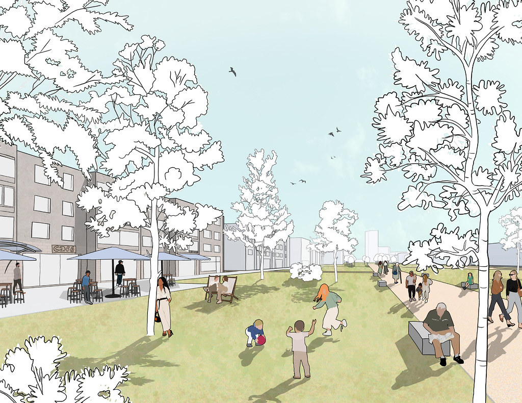
The mission of the new urban plan for Kiryat Eliezer is to keep or remodel the existing buildings, while also filling the gaps with new ones. Beside housing, it also considers public spaces, parks and greenery. After analyzing the public spaces that are available, it was clear that we wanted to add more of those, with different qualities. The green boulevard, that already exists and leads through the center of the area, will be expanded. The streets should become more inviting for bikes and pedestrians, as well as small neighborhood squares that are distributed all over the district. We also want to highlight the importance of the connection between the mountain and the sea.
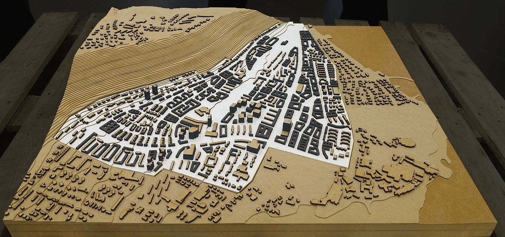
Master plan
Scale 1/1,000
Central Park as green belt

The park surrounding the Tayelet Way flows through the city from a commercial square in the east to the west side of the city, where it abruptly ends. The new plan intends a whole new area at the west end of the park, including multiple activities and an outdoor theater, which is integrated into the natural topography. This end piece of the green boulevard is connected to another square, which invites visitors to cross the street and access the beach, instead of being cut off by the highway.
Use and traffic system
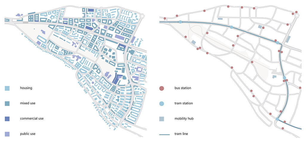
The connection between the mountain and the water is quite relevant for the city. Therefore, it is going to be strengthened by a path leading from a hiking trail down the mountain, through the park and to the water. It is crossing the other strong axis of this plan, creating a significant junction in the middle of the park. To make the entire park more accessible and useful for commuters, more entrances and paths were added.
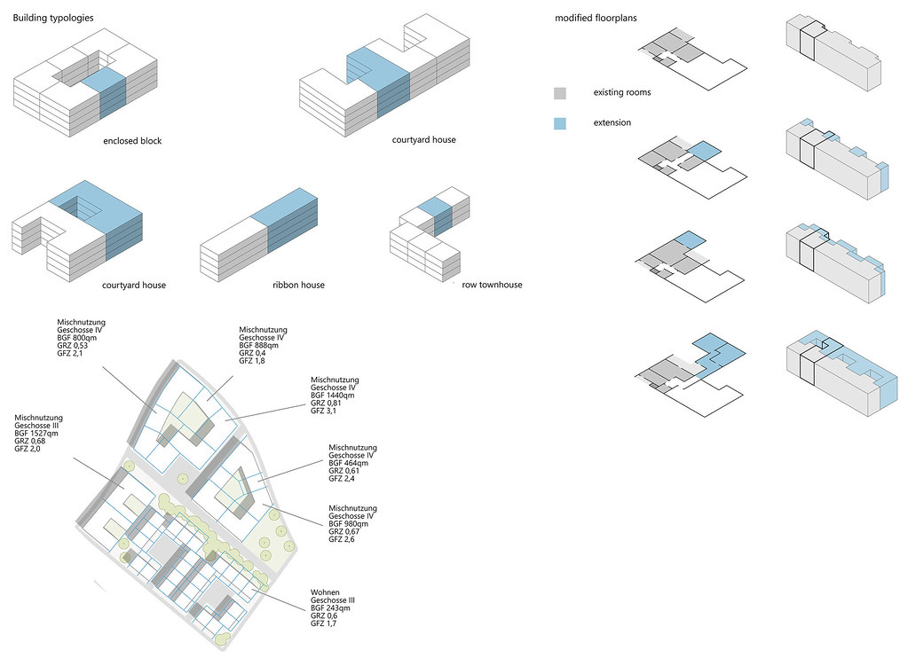
While keeping some of the existing buildings, some were removed to make space for more dense typologies. Enclosed block buildings, courtyard houses and a few row townhouses were added. These typologies were chosen because of the need for private open spaces, such as patios or inner courtyards. The heights are adjusted to the existing buildings, which consist of three to four floors. Mixed-use buildings on the bigger streets are four to five floors high.
By adding and changing the existing structures, this new urban plan is able to increase the density of the designated area by 95%.
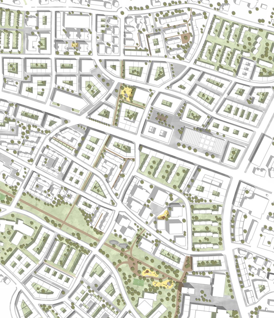
Some of the existing houses are going to get modified by adding more volume. The floor plans allow creating different types of courtyard houses and therefore add more living space without demolishing the old structure. Because of these changes, some buildings got larger apartments, while others were converted into mixed use with shops on the ground floor.
This way we are able to create a small, open commercial area at the edge of the park, instead of hiding the buildings from the pedestrians like before.
End of the green belt to the beach / Around Egged building

Next to the HaHagana Avenue stands the Egged Tower. It’s a brutalism mega structure that was used as the central Bus station of Bat Galim for many years. It stands out of its context and barely connects to its surroundings. A few more buildings around the tower will connect it better to its surroundings. A new plaza which is planned next to the tower will bring more usable open space and quality to the quarter. There will be multiple functions in the building, such as commercial use and mixed use of trade and living. Small businesses will get a space and a chance to grow in a central place. The upper floors in the Tower will be reused as office space or for the public, to help integrate the people into city life. Due to the planning of the new railroad track, the base of the Egged Tower will function as the new station for the public transport. Kiryat Eliezer also will be more connected to central Haifa with the new Tram in the concept.
Section city road and boulevard

With the deceleration of the broad HaHagana Avenue, the new concept provides an alternative traffic network. The Main roads will be less wide and are going to better connect smaller roads. All roads will be more pedestrian and bicycle friendly to encourage a change in the way people move through the city. At the moment, the space surrounding the streets isn’t as attractive for pedestrians, with little commercial use on the main roads. By building a boulevard with equal amounts of space for cars, trams, bikes and pedestrians, the streets will get invigorated. The new roads are inspired by the old road network, with many of them staying the same. The connection between the higher streets on the mountain, the middle part of the park and the streets that lead to the ocean is the purpose of the new traffic net. Beside the bus lines, the concept adds a new tram line. The tram departs from Carmel Beach in the south and leads further north to Haifa Center. The line will cross Kiryat Eliezer through the boulevard and provide an attractive alternative for motor vehicles. To make an exchange of transport as approachable as possible, parking garages have been added in similar distances as stations for public transportation.
Stages of developement

Models urban design
Scale 1/2,000 (towards west, from the inner city)
New center around Egged building
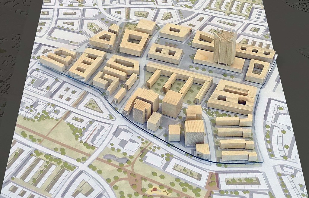
Model scale 1/1,000
Green belt crosses HaHagana Ave and HaAliya HaShniya St (former Allenby Interchange) to the beach

Scale 1/500
